
San Antonio Postal ZIP Areas
The working inventory below is a set of postal ZIPs associated with San Antonio in inspected USPS and Bexar County material. It is described as serving the San Antonio and Bexar area, not as a city-limits roster. Some entries are ordinary delivery groupings, while others are specialized or downtown labels. The Bexar layer supplies the local geometry needed to test a particular point. USPS FAST material supplies destination-grouping evidence. Neither source says that every address bearing a San Antonio postal label lies inside the incorporated city.
| ZIP | Areas covered | Post office grouping | Research note |
|---|---|---|---|
| 78201 | Central San Antonio postal area | USPS/Bexar layer | Exact municipal boundary is not implied. |
| 78202, 78204, 78207, 78283 | Central and east group | San Antonio 78202 destination | FAST groups these ZIPs together. |
| 78203, 78210 | Central, south, and east group | San Antonio 78203 destination | FAST shows the shared destination. |
| 78205, 78206, 78291-78299 | Downtown and central labels | San Antonio 78205 destination | FAST includes 78291-78299. |
| 78208, 78209 | East and central grouping | San Antonio 78208 destination | Use the polygon for a point check. |
| 78211, 78214, 78221, 78224-78226, 78241, 78252, 78264 | South and southwest Bexar service area | San Antonio 78211 destination | Postal service area, not a city line. |
| 78212, 78215 | Central and north-central group | San Antonio 78212 destination | FAST destination grouping. |
| 78213 | San Antonio postal area | Bexar ZIP layer | Specific FAST grouping was not captured. |
| 78216, 78279 | North-central group | San Antonio 78216 destination | FAST grouping. |
| 78217, 78218, 78223 | Northeast and southeast labels | USPS local service | Specific FAST grouping was not captured. |
| 78219, 78220, 78222, 78244, 78263 | East and northeast group | San Antonio 78219 destination | FAST destination grouping. |
| 78227, 78242 | West and southwest group | San Antonio 78227 destination | FAST destination grouping. |
| 78228, 78229 | West and medical-area group | USPS local service | Exact local coverage needs a map check. |
| 78230, 78231, 78248, 78278 | Northwest group | San Antonio 78230 destination | FAST destination grouping. |
| 78232, 78270 | North group | San Antonio 78232 destination | FAST destination grouping. |
| 78233, 78239, 78266 | Northeast group | San Antonio 78233 destination | 78266 is also an outlying Bexar label. |
| 78234-78236, 78243 | Northeast and air-installation group | San Antonio 78234 destination | Destination group, not a land-use label. |
| 78237, 78238, 78254, 78268 | West and northwest group | San Antonio 78238 destination | FAST destination grouping. |
| 78240, 78249, 78255, 78269 | Northwest group | San Antonio 78240 destination | FAST destination grouping. |
| 78245, 78250, 78251, 78253 | West and southwest growth area | San Antonio 78245 destination | Use a polygon for exact coverage. |
| 78246 | San Antonio AMF station label | USPS station example | A station label does not define a city boundary. |
| 78247 | Northeast growth area | Bexar ZIP layer | Exact coverage requires a polygon check. |
| 78256, 78257 | Northwest group | San Antonio 78256 destination | FAST destination grouping. |
| 78258-78261 | North and northwest group | FAST destinations 78258 and 78259/60 | Use polygons for the 78259/60 relationship. |
| 78268-78270, 78272 | Northwest, north, and San Antonio label | FAST or USPS local service | Not every detailed grouping was captured. |
| 78278-78280 | Specialized and central labels | FAST includes 78278/79 with 78216 | 78280 was not separately grouped in the capture. |
| 78284, 78285, 78288, 78289 | Special-use postal labels | USPS local service | Verify by polygon and USPS when needed. |
The inventory includes the inspected sequence from 78201 through 78299, with the individual gaps and ranges preserved as the sources present them. A mailing address should be normalized with USPS when delivery is the question. A parcel, city-limit, or neighborhood question needs a separate geographic check.
Note: The table groups ZIPs only where the local FAST capture or Bexar material documented a grouping, so it should not be read as a complete delivery-route map.
Map San Antonio ZIP Areas
The Bexar ZIP polygon layer is the local starting point for a postal-area search. Its five-digit areas include ZIP, PO_NAME, state, square-mile, latitude, longitude, and shape fields. The service supports text, object-ID, geometry, spatial-relation, distance, out-field, ordering, statistics, and pagination queries. Its metadata calls for annual checking but also carries a March 2016 source marker. Treat it as a useful geographic reference, not as a live promise about postal delivery.
The Bexar ZIP layer interface shows the polygon service and its query controls.
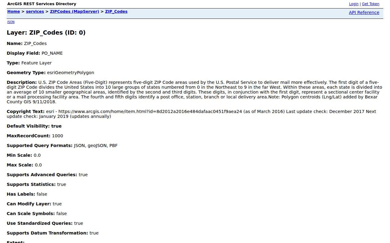
Use the displayed ZIP and PO_NAME fields to form a map question, then compare the resulting shape with the target parcel instead of relying on a postal-city label alone.
Parcel geometry makes that comparison concrete. The Bexar parcel layer exposes a situs, owner and mailing fields, a legal description, an account or property ID, ZIP and ZIP+4 fields, and a shape. The situs is the parcel location. The owner and mailing address fields are not the same thing as an occupancy finding.
Search San Antonio ZIP Records
For a ZIP-focused record search, begin with geography and use the parcel layer as the bridge to official records. BCAD can return parcel data with `Zip` and `Zip4`, and a ZIP query can be paired with situs, legal description, owner, and property ID. The County Clerk's advanced search does not expose a dedicated ZIP field in the inspected interface. After a parcel or map step, use its property address, subdivision, or legal description in the deed index. The Bexar voter lookup also has no ZIP field. It needs a house number, date of birth, and last name for an individual result.
- Find the five-digit area in the Bexar ZIP layer, then test the actual address or parcel against the polygon.
- Query the parcel service for
Zip = '782xx', or intersect the ZIP shape with parcels. Retain the situs, property ID, legal description, and map geometry. - Use the resulting street address or legal description in the Bexar County Clerk advanced search when a recorded instrument is needed.
- For a tax-account question, use the Bexar Tax Assessor-Collector's address, name, or account search. It is address-based, not a ZIP-wide roster.
- When the result must be narrowed to a named street, use the San Antonio street directory route for the full address trail.
Each stage answers a different question. A parcel ZIP is a property field, a Clerk hit is a recorded-instrument lead, and an individual voter result is limited to the county form's own search requirements. Do not collapse them into one claim about a person.
San Antonio BCAD ZIP Fields
The parcel service is ZIP-capable because it carries ZIP and ZIP+4 along with the field set that anchors a result to a parcel. The map service also permits geometry searching, which is useful when a boundary edge cuts through a familiar local label. The BCAD property-search endpoint is available at BCAD Property Search, but the inspected live page returned a browser error. Use the map and REST alternatives if that route fails.
| Field or control | Type | Required | Format or result use |
|---|---|---|---|
| Zip | Parcel attribute | No | Query as Zip = '782xx' for a five-digit parcel filter. |
| Zip4 | Parcel attribute | No | Delivery-precision field; do not turn it into a neighborhood label. |
| Situs | Parcel attribute | No | The physical parcel location used to compare the address. |
| PropID / AcctNumb | Parcel attribute | No | Identifiers for a BCAD account or later record pivot. |
| Shape | Geometry | No | Use for a point-in-polygon or boundary comparison. |
| Text Search | Map control | No | Accepts a whole or partial person or business name, street address, or street name. |
BCAD map results are capped at 1,000 rows. A broad ZIP query can reach that ceiling, so add a map extent, street, subdivision, or another documented criterion rather than treating a truncated table as the whole area.
San Antonio ZIP City Limits
A postal-area boundary and a San Antonio municipal boundary answer different questions. A San Antonio postal-city label can reach beyond the incorporated city. A point inside city limits can also need USPS normalization for its postal city. The research did not locate one official USPS roster limited strictly to the municipal boundary. For that reason, the safer local method is three layers: municipal boundary for jurisdiction, parcel geometry for the property, and ZIP polygon for postal geography.
Boundary check. A postal label is not proof of city jurisdiction, neighborhood membership, or a connection between any person and an address. Compare the parcel and the mapped boundaries before relying on it.
Address authority can differ at the edge as well. San Antonio Development Services assigns addresses inside city limits, while CPS Energy handles addresses in Bexar County's extra-territorial jurisdiction. The same San Antonio mailing label can therefore mask two assignment paths. That geographic distinction is useful before requesting address history.
San Antonio Postal ZIP History
The ZIP system began in 1963. USPS introduced ZIP+4 in 1983 and added two more delivery digits in 1991. The first three digits identify a sectional center or large city, while the last two identify a post office or local area. That structure makes a five-digit ZIP broad by design. ZIP+4 offers more delivery detail, but it still should not be treated as a municipal neighborhood name.
The USPS FAST local table supplies the destination groupings used in the coverage table.
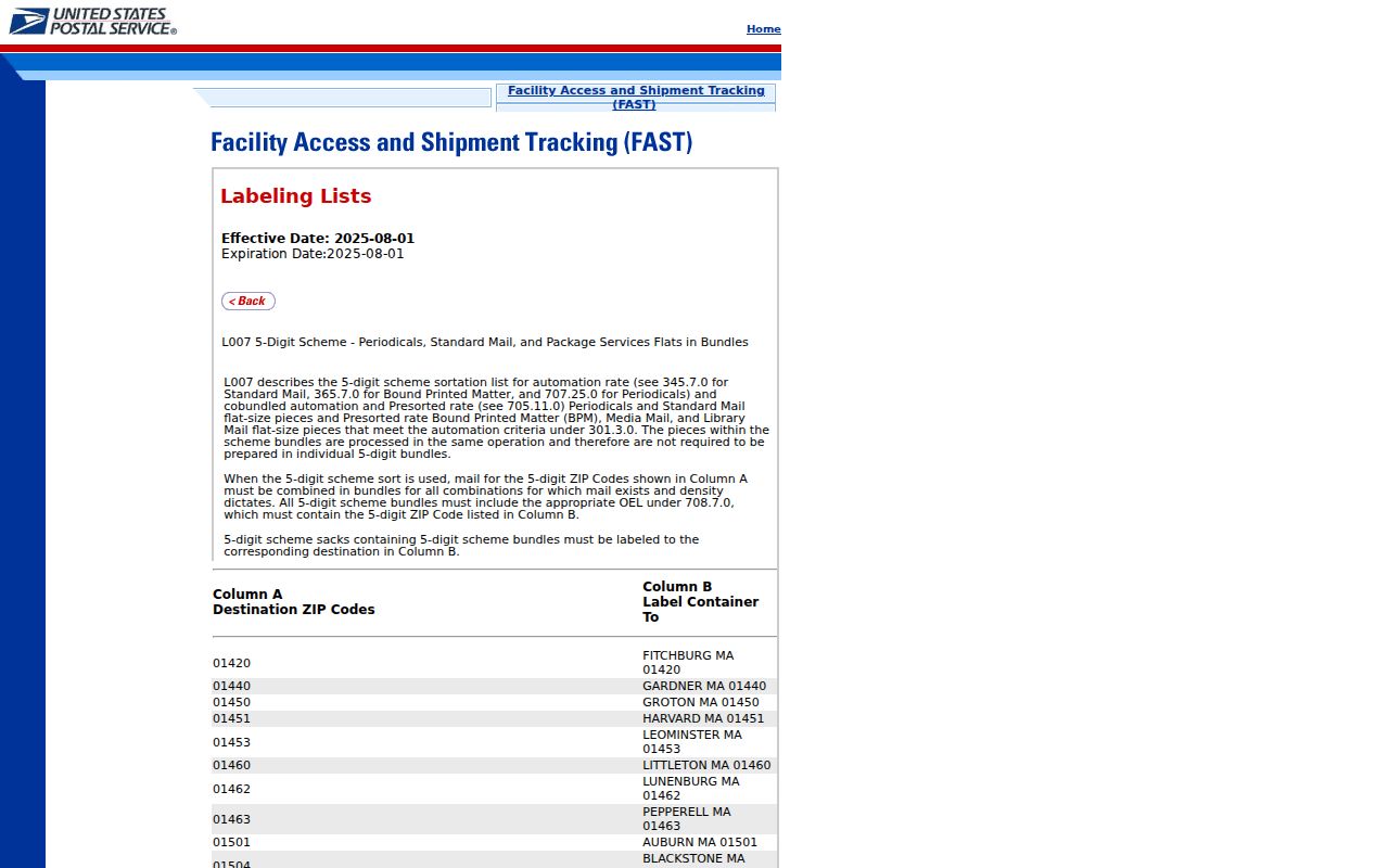
Those shared destinations explain why several ZIP labels can appear together in postal material, without proving that their mapped polygons have the same city or neighborhood boundary.
USPS documented a concrete change for 78260: on July 1, 2007, a realignment replaced 4,301 deliveries previously assigned to 78258. An old letter, directory, or file can therefore carry a ZIP that no longer maps the same way. Preserve the street and the date along with the historical ZIP.
Note: A historical ZIP is useful evidence of mailing geography for its time, but it does not replace a parcel, deed, or address-assignment record.
San Antonio ZIP Terms
Small distinctions prevent a postal search from drifting into an address claim. Use the five-digit area for broad mapping, then preserve the precise form printed on the record being compared.
- ZIP code
- A five-digit postal delivery area. It is delivery geography, not a city-limit or neighborhood boundary.
- ZIP+4
- The five-digit ZIP plus additional delivery digits. It is more granular than a five-digit ZIP but does not identify a municipal neighborhood.
- PO-box ZIP
- A ZIP used for post-office-box service. It should be verified with USPS and not assumed to describe surrounding parcels.
- Unique ZIP
- A specialized postal label associated with a distinct delivery use or institution. It is not automatically a separate city district.
- Carrier route
- A delivery-route grouping used by the Postal Service. It is narrower than a broad area label and is not a local-government boundary.
San Antonio Postal History Search
When the question is historical rather than geographic, USPS keeps a separate postmaster-by-ZIP search. Its form accepts a first-three-digit ZIP range and has Search and Clear controls. The historical output is organized around ZIP, post office, state, date established, and date discontinued. USPS cautions that the database may no longer be current and that many discontinued offices are omitted, so it is a history lead rather than a complete delivery record.
The USPS postmaster-by-ZIP history search provides that separate historical route.
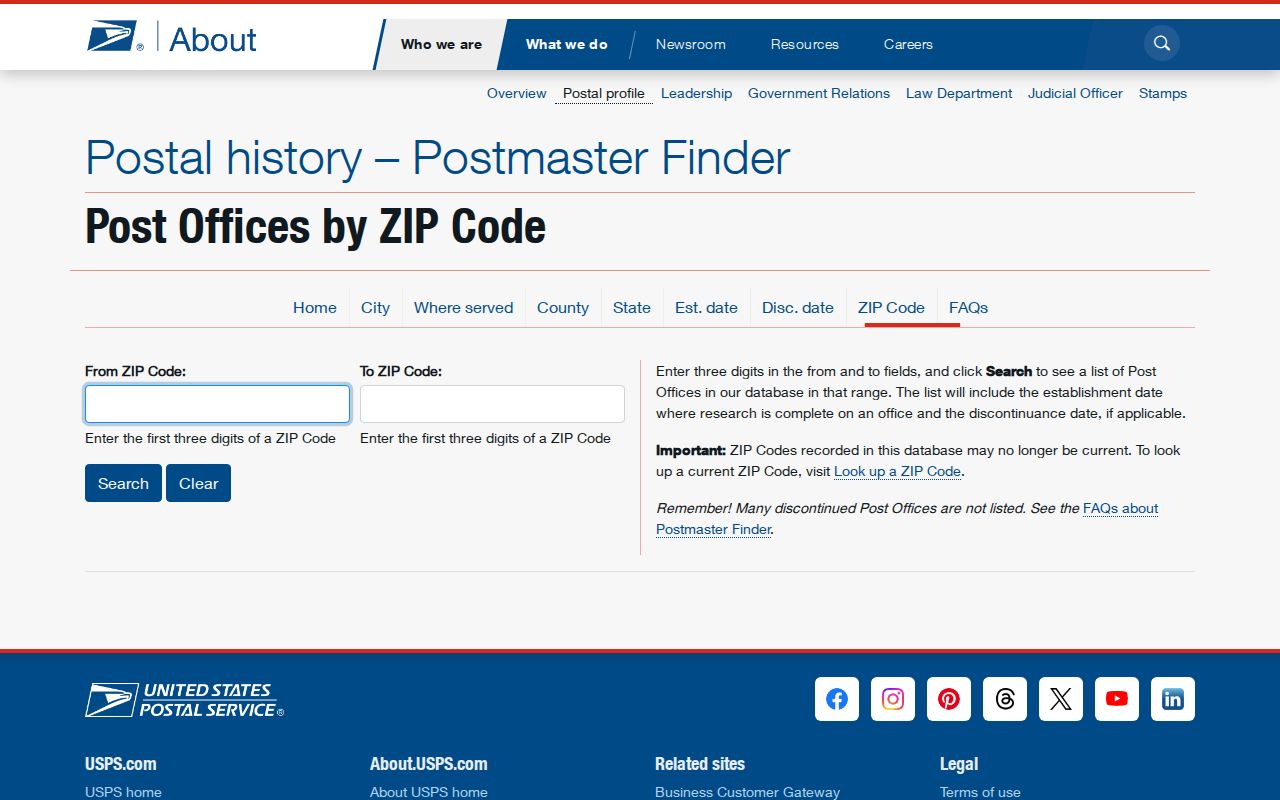
Pair a postal-history result with the address, the document year, and the Bexar polygon or parcel record before drawing a conclusion about the location of an old San Antonio record.
San Antonio ZIP Search Fallbacks
When an online query does not surface the needed record, follow the custody trail instead of widening a ZIP search without a limit. The County Clerk's public search is free to search and view, with copy behavior varying by collection. For a missing image or older series, search the index, use the Clerk counter, ask for a historical-series or copy route, then check San Antonio Public Library, the San Antonio Genealogical and Historical Society, FamilySearch, or the City Archives. A narrowly described Texas Public Information Act request can follow when the custodian may release an existing record.
The City of San Antonio open-records route accepts requests for existing city records by email, portal, mail, or hand delivery. It does not require the city to create a new ZIP-based list. Describe the known address, date range, record type, and geography, and ask for a releasable version if part of the record is restricted.